
Although Boston has a compact downtown of winding old streets, it has an amazing wealth of open space and parks where you can walk and enjoy the urban landscapes framed by trees and grass. The broad Charles River runs within blocks of the bustling downtown area, bordered by a wide esplanade parkland, and from the busiest hub at Park Street and the Boston Common stretches a green belt known as the Emerald Necklace, connecting parks, fens, ponds, public gardens. and an arboretum in an unbroken 1,100-acre chain connected by seven miles of walking roads.
Surrounding the city are leafy suburbs with sprawling parks and public land reserves with rolling hills to climb for views back to the city skyline, and miles of trails along the rivers and bay. Many of the walking routes pass through Boston’s tourist attractions, including historic sites and world-class museums and universities. The Minutemen’s route is traced at the battles of Lexington and Concord.
Read also: Discovering the Charismatic Charm of Boston: A Journey through America’s Historical Beacon
1 Emerald ketting
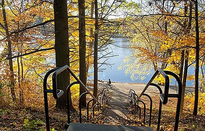
More than 100 years ago, prominent landscape architect Frederick Law Olmsted envisioned a long green space connecting downtown Boston to the suburbs. This emerald chain he designed has survived intact and today connects more than 1,000 acres across six different parks from the Boston Common to Franklin Park . You can walk all or part of the seven miles, returning either on foot or by public transport (closest stops are marked on the excellent Emerald Necklace map). On the way to Dorchester, the route passes two major art museums, famous for Boston Swan Boats , A beautiful rose garden , the historic Fenway Victory Gardens, three ponds, a wildflower meadow, the Arnold Arboretum , and a zoo.
The Emerald Necklace begins with the Boston Common and Public Garden , continuing along the tree-lined park at the center of Commonwealth Avenue , lined on either side by rows of distinguished brownstone and brick houses, which were homes for the “Brahmins of Boston.” You can walk the section from Charles Street, through the Public Garden and the length of Commonwealth Avenue for a 1.5-mile loop, or add another 1.6 miles to a walk through the Fenway Community Gardens and Rose Garden. A popular side route on the Emerald Necklace circles Jamaica Pond ; the main trail runs along the southern side, where there are scenic overlooks.
Adres: Shattuck Visitor Center, 125 The Fenway, Boston, Massachusetts
Official site: https://www.emeraldnecklace.org
2 Battle Road Trail

The beautiful flat trail through forests and marshes along the river seems far removed from its historical context – the first recordings of the American Revolution and Paul Revere’s famous ride. Along with sections of the Battle Road where British troops were harassed by Minutemen firing behind stone walls, the trail traces the route of the Minutemen as they moved from their first skirmish with British troops on Lexington Green to the battle of Concord Bridge . Here the small group of poorly armed farmers faced the British, who moved back to Boston without having taken the guns and ammunition from the settlers in Concord as intended.
Along the 5-mile route, you’ll want to stop to read the historical markers, check out the displays and multimedia presentation at the Visitor Center, take a few side trails, visit Hartwell Tavern , and look around Concord Bridge. The trail is open year-round, although the visitor center is only open from April to October.
Adres: 250 North Great Road, Lincoln, Massachusetts
Official site: https://www.nps.gov/mima/index.htm
3 Blue Hills-reservering

Great Blue Hill ‘s 635-foot summit is the highest of the 22 Blue Hills protected by the reservation’s 7,000 acres that span parts of Milton, Quincy, Braintree, Canton, Randolph, and Dedham, south of Boston. Climbers are rewarded with sweeping views of the entire metropolitan area from the rocky summit, but this is only part of the park’s 125 miles of trails. Some lead to sites with evidence of Native American presence here, others past remnants of early ranches and old quarries.
The park protects natural habitats that you can explore on trails that pass ponds, marshes, and swamps, and through high and low forests, meadows, and an Atlantic white cedar swamp . The six-mile Skyline Loop involves some serious exercise, with rock scrambles and plenty of ups and downs. Maps are available at headquarters and the park rangers are helpful in suggesting and describing routes. Also in the park are the Blue Hills Trailside Museum and the Blue Hill Observatory and Science Center , at the top of Great Blue Hill. You can reach the park by public transport.
Adres: 695 Hillside Street, Milton, Massachusetts
4 The Atlantic Path and Halibut Point

A scenic two-mile coastal walk, over rock ledges that run down to the sea, begins just past the Emerson Inn on Cathedral Avenue in Rockport and continues to Halibut Point State Park . Here you will find 2.5 miles of hiking trails along a more rocky coast and around a granite quarry that is filled with springs. An interpretive trail explains the operation of the quarry and the fascinating history of this point. Granite quarried and cut here was used for paving stones and Boston’s Custom House Tower. Learn about Halibut Point’s and Cape Ann’s granite mining and natural history at the visitor center and museum.
Views along the coast stretch as far as Ipswich Bay up the coast to New Hampshire and Maine. Birders will like this park, with its rocky coast covered in bayberry and shad, good habitats for small birds. The Atlantic trail continues from the other side of the park.
Location: Rockport, Mass
Official Site: https://www.thetrustees.org/places-to-visit/north-shore/halibut-point-reservation.html
5 The end of the world

The rolling hills and rocky shores of 251 acres of World’s End, 15 miles from the south coast city, has something for everyone: hiking, cross-country skiing, snowshoeing, kayaking, canoeing, bird watching, horseback riding, and mountain biking. Like the harbor islands, the hills of World’s End are drumlins, left behind by retreating glaciers, which have also scraped the granite ridges now covered with blueberry bushes and cedar.
Trails skirt saltwater marshes and cross forests and meadows that are important habitats for birds and native plants. From its hills and coast are views of the Boston skyline , and meandering through the park beneath a tree canopy are carriageways designed by landscape architect Frederick Law Olmsted. These carriage paths and hiking trails add up to 2.8 miles of moderate walking. Although World’s End is administered by the Trustees of Reservations, it is part of the Boston Harbor Islands National Park Area.
Adres: Martins Lane, Hingham, Massachusetts
Official Site: https://www.thetrustees.org/places-to-visit/south-shore/worlds-end.html
6 Charles River reservation

Boston and Cambridge share the Charles River, which flows in a broad band between them. On each side is a green strip with walking and cycling paths that make good loops, thanks to the well-spaced bridges. The Charles River Reservation is a linear park that extends 20 miles upstream from Boston Harbor. On the Boston coast, it encompasses the broad Esplanade and on the Cambridge side, it skirts the scenic campuses of Harvard and MIT . The best view of the Boston skyline is from MIT’s shoreline, with the river in the foreground, dotted with sailboats.
Several local trail networks converge, exit, and intersect the trails along the river. The Charles River Link is a 16-mile route along one of the most beautiful stretches, connecting green areas to Newton, Wellesley, Needham, Natick, Dover and Medfield. The Wellesley Trails network, of which it is a part, follows the Charles River and passes through the city forest and along Longfellow Pond. The portions of the riverfront trails on the Boston side are heavily used by cyclists, rollerbladers, and runners, so walkers should be alert and stay to the side to avoid awkward encounters. For less traffic and more nature, head to suburban riverside trails.
7 Breakheart reservation

Almost unknown to all but those who live nearby, the 640-acre Breakheart sits along a rugged stretch of the Saugus River, north of Boston. In the hardwood forest are two lakes and seven hills, rocky outcrops just over 200 feet high, but high enough above the forest for views of Boston and southern New Hampshire. Hiking trails encircle both lakes, border the river and form loops in the park. The banks are popular with bird watchers. In the summer, the park can be packed with swimmers on the lake’s beaches, but even then you’ll likely have the trails to yourself.
Adres: 177 Forest Street, Saugus, Massachusetts
Official site: https://www.saugus.org/
8 Appleton Farms Grass Rides
With loan cars, the English term for a carriage path, the grassy footpaths of Appleton Farms were originally bridle paths, and five of them converged like the spokes of a wheel at the “Roundpoint,” a clearing with a large granite pinnacle in the center. This and three other stone spires were given to the Appletons, whose manor house this was, when the old Harvard library was demolished. The family had longstanding ties to Harvard. In addition to the Grass Rides, Appleton Farms maintains six miles of walking trails, bridleways, and country roads accessible to walkers and horse riders (the latter with a permit).
Appleton Farms Grass Rides consists of a mix of forests, fields and wetlands, which were once more extensive than they are today, but were drained by early farmers. You will see examples of skilled stonework in the bridges and culverts around the property. The wetlands here are spring-feeding stops for migrating wetland birds and for migrating hawks in the fall. The vast grasslands are home to one of New England’s largest bobolink and meadowlark populations. Visit the working farm to collect bread and cheese from the dairy for a picnic.
Adres: 219 Country Road (Route 1A), Ipswich, Massachusetts
Official Site: https://www.thetrustees.org/places-to-visit/north-shore/appleton-farms.html
9 Middlesex Fells Reservation

With 2,575 acres of rocky, hilly terrain, the Middlesex Fells attract serious walkers, as well as hikers taking a walk through the woods. The first finds a demanding five-hour hike on the seven-mile Skyline Trail , across a boulder-strewn terrain of woods and ponds, with repeated ascents and descents. The main trail leaves Bellevue Pond, where white fires lead to Pine Hill, topped by a lookout tower with great views across the reservation to Boston. Go north from the tower and follow the fires on the rocks.
More than 60 miles of trails lead through the reservation, revealing meadows, ponds, Wright’s Tower, and Virginia Wood, the site of a vanished Haywardville mill village. Here you will find an interpretive trail through the forest of the pine trees that describes the history. The park reveals much more local history, from half-timbering, quarries, ice harvesting and water that powered local mills. A trail map, available at the visitor center, will direct you to trails that cross the Rock Circuit and Crystal Springs Loops in the Eastern Fells and to the Cross Fells Trail that traverses the entire property. Allow more than four hours for the 3.7-mile Rock Circuit, one of the park’s most difficult.
Adres: 4 Woodland Road, Stoneham, Massachusetts
Official Site: https://www.friendsofthefells.org/trails/
10 Mount Wachusett

The tallest mountain near Boston, at an elevation of 2,006 feet, Mount Wachusett is popular with skiers in the winter and hikers the rest of the year. On clear days, the view extends to Mt. Monadnock in New Hampshire, the Berkshires in western Massachusetts and the Boston skyline. Surrounding the summit, the 3,000-acre Wachusett Mountain State Reservation protects forests, mountain meadows, ponds, streams, fields, and a raised bog, all of which you can explore on the 17 miles of hiking and walking trails. The reservation includes 3.9 miles of the Midstate Trail , which runs across the state from the New Hampshire Line to the Rhode Island border.
The largest area of old growth forest in eastern Massachusetts lies within the park, with trees more than 350 years old. Balance Rock , where two large boulders are stacked on top of each other, shows the power of moving glaciers at the end of the Ice Age.
Adres: 345 Mountain Road, Princeton, Massachusetts
Read also: